A GIS based tool for project monitoring and review
Summary :
aKasmika allows organisations to visualise data on a map and to analyse data from national to household levels.
NGOs are increasingly applying data to review and resolve development problems. Effort is going into creating baseline data which is then compared with subsequent data after the NGO's intervention. To do this NGO's typically use Management Information Systems (MIS) that can store and analyse large amounts of data and provide reports for the review and evaluation of an NGO's programme.
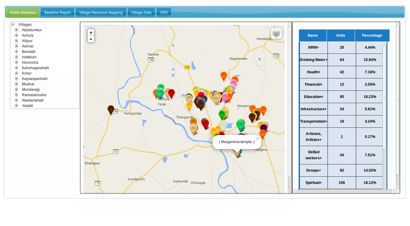
aKasmika is an MIS with a difference. It is a Geographical Information System (GIS) that allows an organisation to collect and map data from a household or plot level and allows aggregation of this data at each of its above levels. Users can access data and reports at the levels required – national, state, district level, village to the household for project evaluation and review. Because this data is visual, it can also be viewed in conjunction with other factors occurring around it, and which has been mapped. aKasmika can be used for any GIS based survey, and is easily customisable to any cause.
How NGOs are using aKasmika
aKasmika is currently being used
• by Kalike, a resource organisation of the Sir Ratan Tata Trust (SRTT) as a livelihoods database;
• by the MS Swaminathan Research Foundation to explore the use of the Carbon Bio Village as a climate monitoring tool to understand the climate impact of its interventions on three villages;
• by ICAR (South Zone) to plot the PRA processes of one of its research projects; and
• by the Climate-Neutral Village, a climate adaptation tool managed by iSquareD to help climate-vulnerable communities to understand and plot their progress by specific milestones on the road to adaptation.
aKasmika is presently building a GIS/MIS Data Backbone for Hindustan Unilever Foundation.
A tool for transparency and accountability
T Pradeep, the Founder of aKasmika, says, “This tool allows people working on the ground to make decisions based on hard data and creates transparency of activities and effort for donors.”
If you would like to know more about aKasmika, you can email tpradeep812@gmail.com
Mahiti is the technology partner for aKasmika. Over the last year we have built GIS -MIS tools and customised them for use for over ten projects for aKasmika. Our team has gained immense understanding of the social aspects of GIS and are now in the process of building a comprehensive product for aKasmika on Geo MIS.